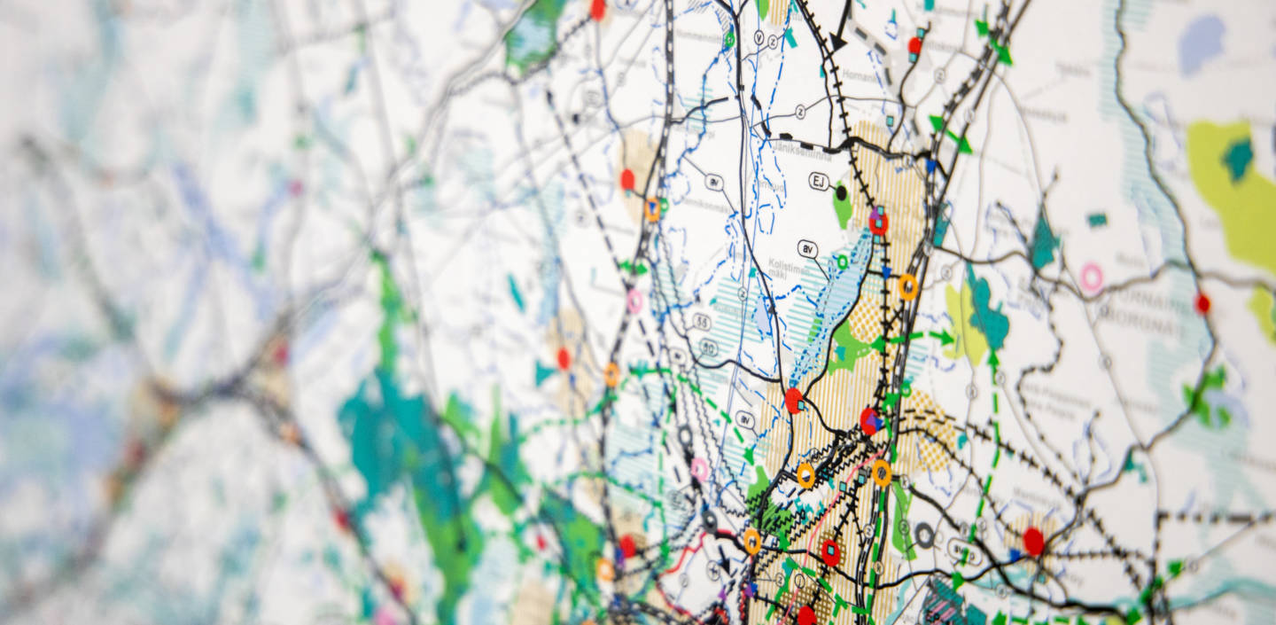
Our regional land use plans set out the principles of land use and the community structure in Helsinki-Uusimaa. They define the use of areas needed for specific purposes, along with the principles of urban structure.
These plans are long-term plans and guidelines for our member municipalities when they are drawing up and amending local master plans, as well as local detailed plans. We make our land use plan concrete by a map with a land use classification indicating a desirable future, also including a written statement.
Every regional land use plan is drafted by a regional council and approved by its assembly. The land use planning in Finland is defined in the Land Use Act.
Learn more about the regional land use plan:
Helsinki-Uusimaa Regional Land Use Plan 2050
The Helsinki-Uusimaa Regional Land Use Plan 2050 covers almost the entire region and it has a time span until the year of 2050. It became legally binding by a decision of the Supreme Administrative Court in 2023.
The Helsinki-Uusimaa Regional Land Use Plan has the following four main targets:
- Steering sustainable growth and a regional balance
- Facing climate change and the sustainable use of nature and natural resources
- Increasing welfare and attractiveness
- Enabling sustainable competitiveness
The Plan has two different levels; firstly, a strategic structural plan for the entire Helsinki-Uusimaa, which is then completed by three thematic regional land use plans. We have made these thematic plans for the Helsinki Metropolitan Region, the Eastern and Western Uusimaa.
Our structure plan deals with the greater lines of the regional structures, which are the network of centres, the structures of densely populated areas, traffic connections and the most important green structural entities. This plan also includes an order in which development directions are to be focused upon. All regional land use plans deal with such issues that each region wants to especially focus upon.
Learn more about Helsinki-Uusimaa Regional Land Use Plan 2050:
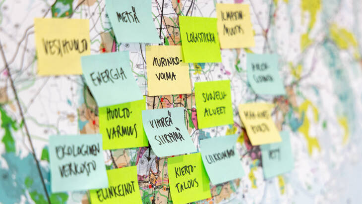
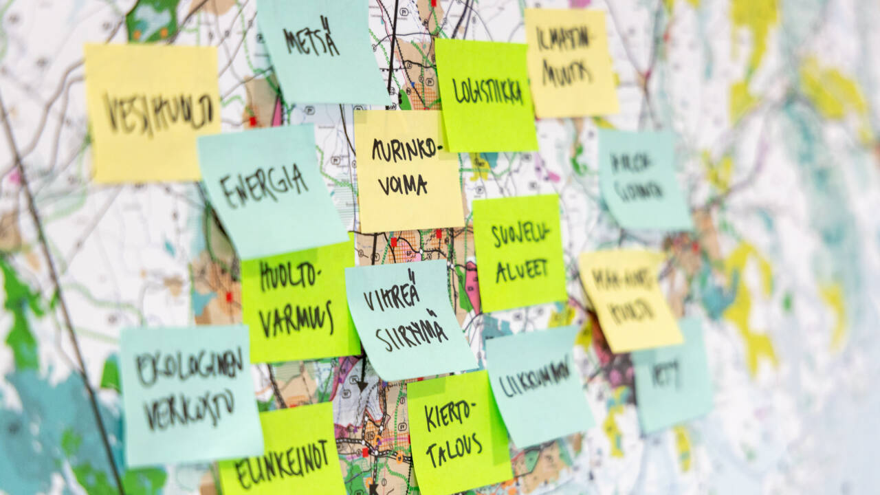
VISIO plan focusing on themes relating to green transition
We started preparing a new thematic land use plan in May 2024. The aim is to support the land use planning in municipalities and in that way make the implementation of pure and green transition projects in Helsinki-Uusimaa smoother. This comprehensive plan, aiming at the year 2050, is made for the entire region.
The VISIO plan completes the legally valid Regional Land Use Plans in Helsinki-Uusimaa with six thematic areas relating to green transition:
- Energy
- Industrial production, circular economy and soil management
- Nature and carbon sequestration
- Logistics and long-distance passenger transportation
- Water supply and resources
- National defence
All themes will not be visible on the plan map, but can be advanced, for example, with reviews or projects during the work process. Some plan themes will be updated to meet the current needs.
The Helsinki-Uusimaa Regional Council is working on the VISIO plan during 2024–2027. Important stakeholders are regional municipalities, authorities and green transition actors. The work proceeds in phases, from the start to the approval – and implementation. It is possible to give response during the process.
New Regional Plan focuses on themes relating to green transition
The Helsinki-Uusimaa Regional Council started the process of a thematic green transition land use plan in May 2024.
Other Regional Land Use Plans in force in Helsinki-Uusimaa
- Regional Land Use Plan for the Östersundom area
- Thematic Regional Land Use Plan 4 – only markings for wind power.
Find out more

Helsinki-Uusimaa Regional Programme
As a regional council, we are responsible for the development of Helsinki-Uusimaa. Our work looks far ahead, while also shaping development actions in the coming years. To support this work, we work with regional stakeholders to develop joint strategies and programmes.


For more information, please contact:

Ilona Mansikka
Regional Planning Manager
ilona.mansikka@uudenmaanliitto.fi
Regional land use plan and developing its work process. Responsibility for the VISIO plan. Areas of responsibility in regional land use planning: Espoo, Helsinki, Kaunainen and Vantaa. Deputy for Director of Regional Planning Mari Siivola
Current
 News
News
26.3.2026
VISIO plan supports the green transition in Helsinki-Uusimaa – draft plan on display from March to May
The new regional land use plan shows how future energy solutions, major transport projects and green transition clusters can be combined with environmental and natural values in densely populated Helsinki-Uusimaa. The draft plan is on display on the Helsinki-Uusimaa Regional Council’s website from 11 March to 8 May 2026.
 News
News
16.12.2025
Policy change opens up EU funding for West Railway
Ministers responsible from the EU member states met on Monday, 15 December, to discuss, among other things, the Council’s position on the future CEF programme. As a result of the meeting, Finland saw a major positive development, as the Tallinn–Helsinki–Tampere and Helsinki–Turku–Stockholm connections were added to the list of CEF priorities. It is very important for transport projects to be included on the CEF list, as this gives them the opportunity to apply for EU funding.
This page was last updated: 3.3.2026